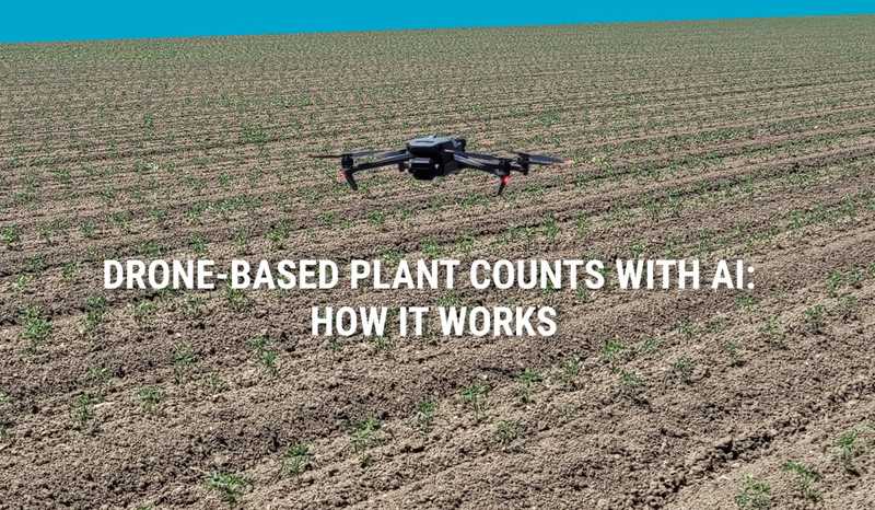
Drone-Based Plant Counts with AI: How It Works
October 11, 2023
Plant stand counts are invaluable to agricultural research. Knowing the number of plants in your trials is useful for germination assessment, phenotyping, yield projection, and assessing seed quality. But does the count methodology matter? It depends if you are making consequential decisions from the data.
What’s the Best Way to Count Plant Stands?
There are two basic approaches to plant counts: manual (row sampling) and image-based (computer-powered). They may return the same type of data, but the methodology and uses are worlds apart.
Traditional Manual Plant Counting
Researchers have been using row sampling to manually estimate field populations for years. It’s a classic technique taught in any basic agronomy course for crops like wheat or corn. Given the time and willingness, you can count any crop at any growth stage. And it’s not wrong. If you need only a ballpark gut check, it’s an option.
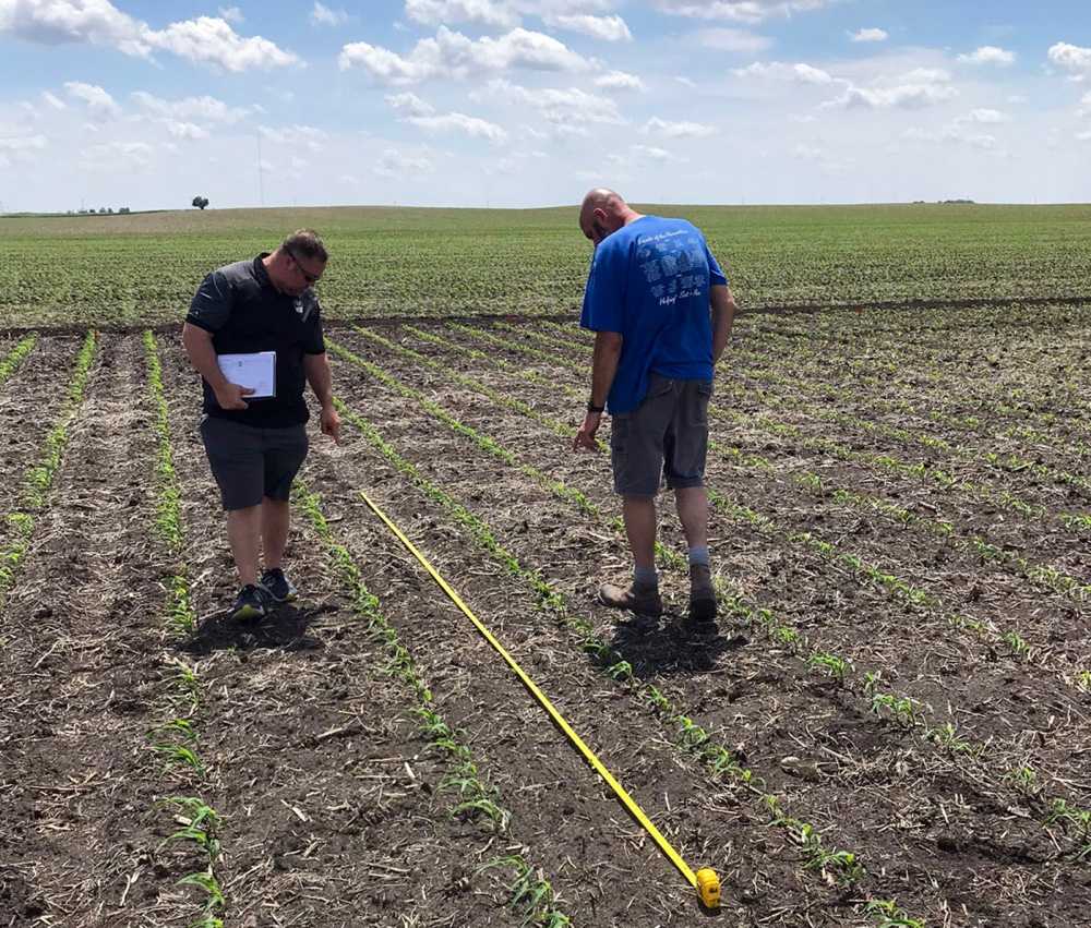
But there’s a difference between accurate and precise. When margins matter, you need hard data in rapid time. Something manual data collection may not offer.
Today, image-based plant counting offers fast, full-field plant counts, even at very early growth stages.
What is Image-Based Plant Counting?
Taking a photo captures a moment in time. With enough perspective (and detail) you could theoretically see and count every plant in the photo for a complete field inventory. Except, that is beyond impractical.
Fortunately, computer imaging systems can perform these actions on autopilot.
Why Use Image-Based Plant Counts?
- Accuracy - Random sampling is just that - random and a sample. All fields have variation and all humans are prone to error (frequently in math!). Using image-based counts accounts for field variability and eliminates human error or bias.
- Completeness - Image-based counting uses your entire field image - short rows, thick rows, and even the ones with weeds.
- Speed - With the image in hand, plant counts are available in minutes with other rich datasets as well, like vegetation indices, thermal maps, and more.
- Field distribution - Because you’re examining the entire field, you can identify relative performance strengths and weaknesses in the field for investigation or management.
- Documentation - Imagery counts create a visual record of the field for comparisons over seasons or in-season over time or between fields. Either way, you’re creating records that are easy to access and analyze even later in the season.
- Data overlays - Because field imagery is geolocated, it can be overlaid with additional data like topography and yield data.
Once you’ve decided on image-based counting, you’ll need a field image to get started.
Drones vs. Satellites for Plant Counts
Drones and satellites can both render complete field imagery but there are some key differences that are crucial if you need to extract data from these images.
Image Resolution
Counting plants requires extremely high resolution to distinguish plants and even discern between plants and other objects, like weeds. In corn, at VE-V1 you’d need a minimum of 0.5-1 cm/pixel to even recognize plants.
Satellite data can, at best, provide resolution of 30 cm/px which is simply not high enough for this use case.
Drone image resolution, on the other hand, simply depends on your sensor and flight altitude. A standard drone with RGB camera flown at 20-30 meters provides imagery with < 1 cm/px resolution.
Timeliness
Satellite imagery is only available at certain intervals when your field has been in view. If that timing doesn’t align with your needs - or the weather - you’re out of luck. Drone imagery can be captured at almost any time and even rescheduled or retaken if the weather doesn’t cooperate. Clearly, that’s a flexibility win.
Phone Apps
There are even smartphone apps now that will count plants from photos taken at different field locations. While they use image-based counting, they rely on random sampling and are just a step above manual counting - if the photo and algorithm are good.
Which Plant Counts Platform Should You Use?
Not all imagery analytics counts are the same. There are two basic approaches: computer vision and machine learning. While both use drone imagery, the methodology is different and can dramatically impact results.
What is Computer Vision for Plant Counting?
Computer vision enables computers to identify and interpret visual information similar to human vision, like from a photograph. It allows machines to scan images, recognize objects, detect patterns, and extract insights from visual inputs using a range of image processing algorithms for finding shapes, detecting edges, removing background noise, etc.
For plant counting, platforms using computer vision often depend on a greenness index, like Excess Green Index (ExG), which can be effective when there is a clear color difference with the background (soil). Using this or a similar index, users can find a threshold that “removes” soil or other non-green objects from the image, making it possible to extract plant shapes and generate counts. But in later growth stages, non-green plants, or areas with weeds or other green objects, the method can fail.

As an example, in this video by MicaSense, the tree counts are generated using a series of different image processing steps:
- Calculate OSAVI vegetation index
- Re-classify OSAVI layer so pixel with values above certain threshold are assigned 1 and the rest - 0
- Remove noise (small pixels) using Sieve algorithm
- Vectorize (convert raster values to polygons) the filtered results
- Use buffer tool to merge smaller polygons belonging to the same tree
- Convert polygons to points by extracting centroids
- Use a series of additional post-processing steps to identify and cleanup false positives
Using a series of steps described above, it is possible to create a workflow that works relatively well in a specific set of crops at certain growth stages. But adding support for new, visually distinct crops, often requires a different algorithm, making it an inflexible and costly option that requires deep technical computer vision expertise!
How is Machine Learning used for Plant Counting?
Machine learning is a form of artificial intelligence that lets computers learn from data and make iterative decisions without being explicitly programmed for a specific crop or growth stage. It uses computer algorithms to analyze and recognize patterns in large image datasets and aggregate those patterns into models that can later be used to identify objects or plants in new images.
Unlike computer vision, machine learning models do not require algorithm or code changes to adapt to new types of crops or growth stages. Instead, this can be achieved by just adding more example data and retraining the models, which, given the right tool, anyone can do without having a degree in machine learning! The user essentially teaches the model, with increasing accuracy, what to look for.

Solvi’s Plant Counts with AI is Machine Learning for Agricultural Analytics
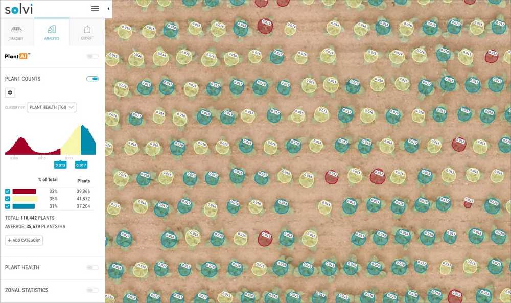
At Solvi we use machine learning approach and have developed our PlantAI tool that makes it click-and-drag easy to add examples and train customized models. Here’s how it works.
1. Create A Sample
Once your field imagery has been uploaded and stitched in Solvi’s cloud-based platform, you start by identifying which plants you want to be counted. Select at least ten plants (but the more the better) in the image by clicking and dragging to form a circle around each plant. Choose examples in different rows, lighting, and sizes to show the range of acceptable results.
2. Review Initial Results
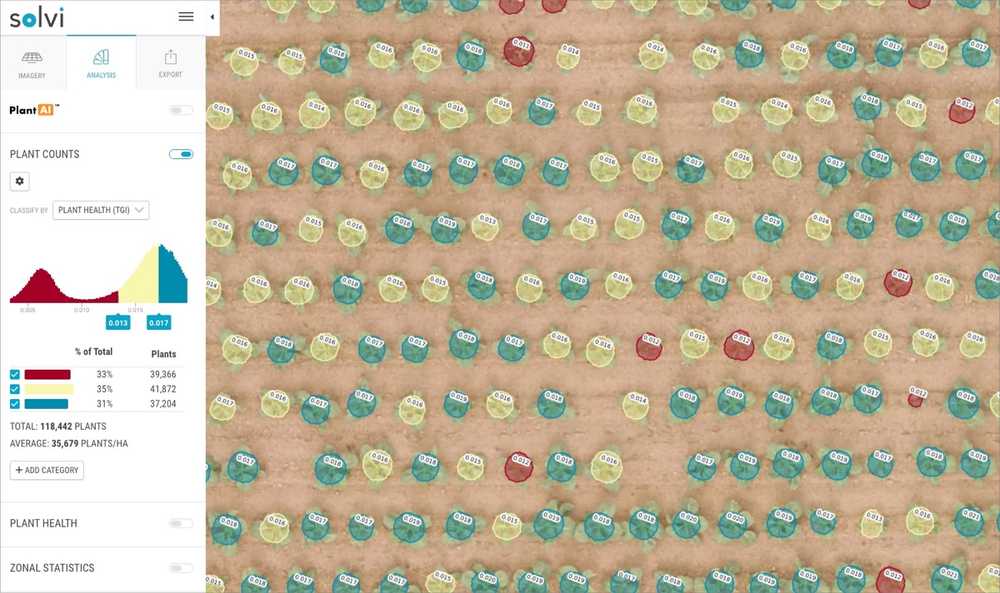
The PlantAI tool will then train a custom AI model for the user’s specific field and then match similar plants in the field based on the unique visual pattern of the plants, including shape, size, color, etc..
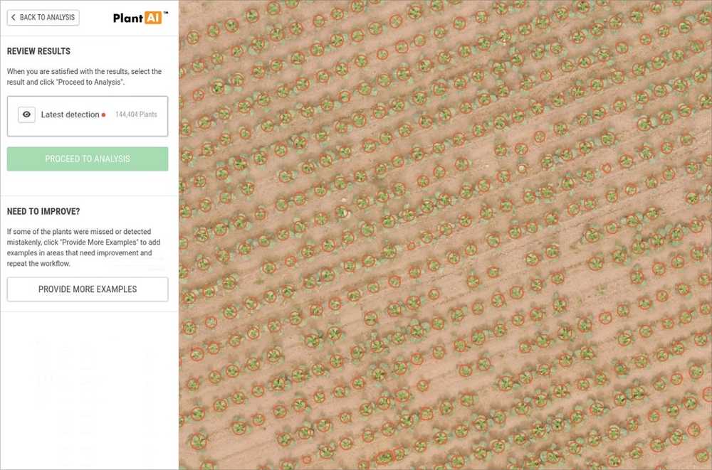
The field map will display a dot or outline on each counted plant so that the user can assess the accuracy of the results. Initial results may be spot-on accurate, or they may need some refinement. That’s where machine learning shines.
3. Iterate for Improvement
By repeating the process, selecting additional plants in a great range of examples can help improve results. Each iteration gives Solvi’s models a training score which should improve and tighten outcomes.
The number of rounds of training you provide depends on plant growth stage, image clarity, conflicting field objects, and your needs. Do as few or as many rounds until you are satisfied with the results. In most cases, good accuracy can be achieved after just 2-3 iterations.
When Machine Learning Plant Counts are Essential
Certain crops and uses necessitate more sophisticated plant counts using machine learning.
- Crops with non-green leaves (especially lettuces) or minimal leaf canopy in early growth stages
- Crops at later growth stages where greenness may be ubiquitous
- Fields with abundant weeds, shadows, rocks or other non-plant objects
- Orchards or vineyards with grass between the rows
- When you need or want additional plant-level data
- Anytime high accuracy is essential
User-Trained or Done-For-You Plant Counts
Solvi’s click and drag model training system is simple to use. And plant counts are available fast, usually in less than an hour. But in some seasons, you can’t even spare that time.
When you’re pressed for time or have a high volume of counts to execute, Solvi offers a done-for-you service. We’ll train the models and refine your data for the highest accuracy and send you a report, usually within 24 hours.
Advantages of Solvi’s AI-Powered Plant Counts
- Specific - Solvi’s entire drone analytics platform was designed and built exclusively on agricultural models. Over the last seven years, we’ve analyzed tens of thousands of fields for the most sophisticated algorithms.
- Accurate - Our customers report accuracy rates of up to 98% in vegetable crops
- Customizable - Solvi offers the only user-trained model that allows you to define and adjust the counting parameters.
- Flexible - Choose your level of detail: basic counts or PlantAI-assisted counts with plant-level data.
- Easy - Solvi’s click and drag model training is fast to learn. We also provide a guided walk-through and developer support (not a call center!).
- Fast - User-generated counts are available in less than an hour and outsourced counts are done in one day.
Agricultural Expertise
At Solvi, we’ve counted thousands of crop fields for growers, agronomists and agricultural researchers around the world. Our sophisticated plant counting algorithms were built by and for agricultural research, making them the most accurate available.
Leading breeding and research organizations, including Rijk Zwaan, Agrovista, Nordic Beet Research, the Swedish University of Agricultural Sciences and others, use Solvi’s image-stitching and analytics tools to improve their data collection speed and accuracy.
Looking to extract plant-level data from your drone imagery? Try counting your entire field with Solvi for free today.
