Drones and scissors help decide fertilizer rate
November 01, 2019
Both Swedish and European field trials show that winter oilseed rape that has taken up a lot of nitrogen in autumn needs less nitrogen in the spring. A thinner crop, which has not assimilated so much nitrogen in the autumn, needs more N fertilizer in the spring. In order to determine the autumn’s nitrogen uptake, the so-called “cutting method” is often used in Sweden.
Drones guide the cuttings
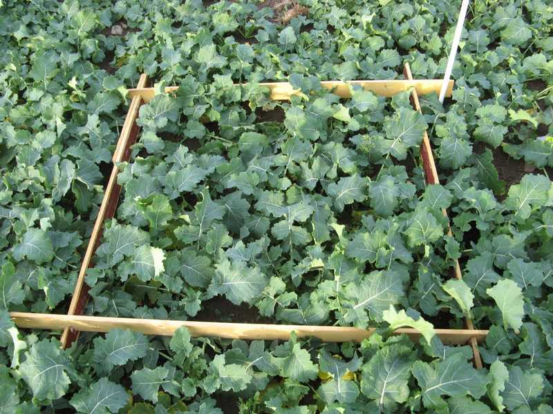
Before the winter a farmer would cut the crop within 1 m², in one or more places on the field, and weigh it. The nitrogen rate in the spring can then be calculated using a formula where the fresh weight of the cut biomass, expected harvest and estimated soil mineralization are taken into account. To obtain a representative value that corresponds to an average for the field, the crop should be cut in multiple locations in the field. What you get is an average amount of nitrogen for the whole field. As mineralization usually varies within the field, it is in most cases interesting to also use variable rate application. Using drones to scan a field is a fast and more efficient method to map variations compared to driving a tractor equipped with a crop sensor. A drone with RGB or multispectral camera can quickly map one or more fields, and based on the imagery, vegetation indices that show the N uptake variation within the field can be calculated. While there is a lot of ongoing research in this area, at the moment, these index values can still not be directly converted into nitrogen rate. However, when combined with cuttings at strategic locations, a prescription file can be easily created.

Download The Drone Crop Scouting Schedule™ for FREE
Learn when to fly a field for actionable decisions and peak profits
Get your free pdfPractical example
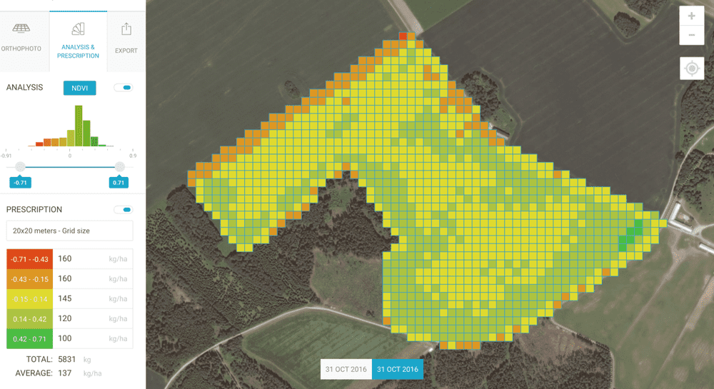
On October 31, 2016 the field was mapped with a DJI Phantom 3 drone equipped with a multi-spectral camera. The images have then been uploaded to Solvi, where an index map was created using NDVI vegetation index:

The map showed 4 vegetation index classes with two of them (yellow and green) covering most of the field. Based on that map, two places were selected in the field where 1 m² of oilseed rape was cut and weighed. Despite a fairly similar crop canopy in the two test areas, there was about 35% difference in fresh weight — 1.08 and 1.45kg respectively. The nitrogen rate in the spring was calculated using the formula that according to the Svensk Raps (Swedish )website is following:
Spring rate (kg N/ha) = 159 — (61,875 cut biomass (kg/m²) — (1,1N-mineralization (kg N/ha)) + (0,021*expected yield (tonnes/ha )
Using the formula, the calculated rate was 145kg N and 120kg N assuming 4 tonnes/ha yield and normal mineralization of 30kg N. As drone imagery revealed several levels of variation, it was decided to split nitrogen rates into 4 levels — 160kg, 145kg, 120kg and 100kg. Having entered these numbers into corresponding fields in Solvi, a SHAPE file compatible with fertilizer spreader could then be downloaded.
Variable nitrogen rate, in this case, could be compared with an average of 145 kg/ha that would otherwise be applied across the whole field, which means about 285 kg N were saved. In addition to environmental benefits, more efficient use of nitrogen increases crop potential and may result in more even crop quality and higher yield.
The combination of weighing green biomass and scanning the field with a drone is a simple, fast and cheap way to optimize nitrogen application for winter oilseed crops. When done properly, better yield potential, better use of nitrogen and advantages of more even crop establishment can be expected. In addition to a drone, only scissors, scales and a fertilizer spreader capable of variable-rate application are required.
