University of Florida Corn Contest Puts Precision Agriculture in Growers Hands
February 14, 2024
Precision ag technology, like drone imagery, holds great potential to improve production efficiency, but most growers want to see the proof in the pudding before investing time and money. So what’s the best way to make on-farm technology accessible?
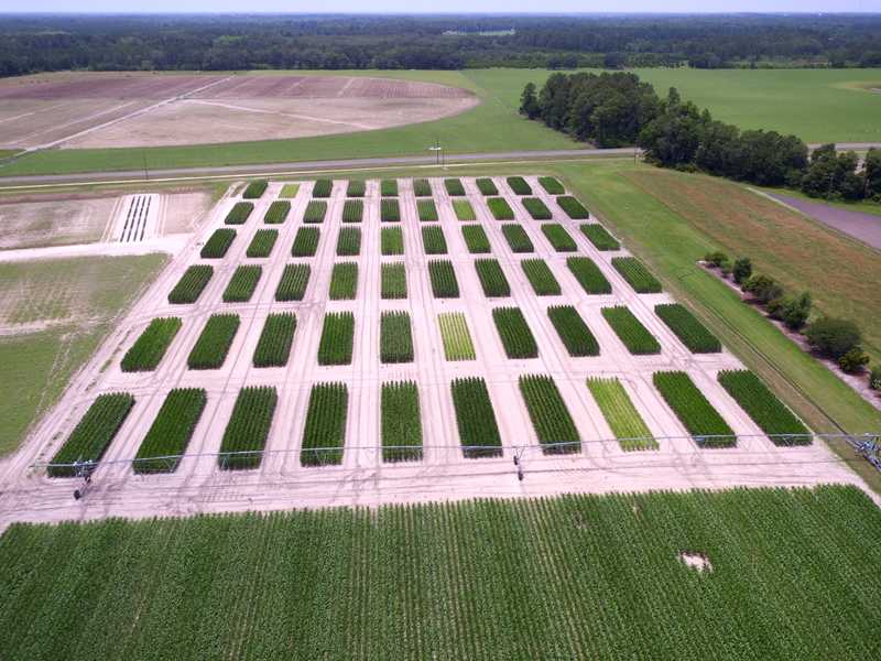
University of Florida researchers are gamifying it. Their annual corn contest allows growers to experiment with technology-driven decision-making using drone imagery and other data streams in a real-world fantasy farming contest.
University of Florida STEP Corn Contest
The 2023 UF Stakeholder Engagement Program contest, funded by the Florida Department of Agriculture and Consumer Services, provided 14 teams of growers, extension agents, consultants, and industry professionals with a level playing field to experiment with advanced agricultural technology including drone imagery, soil moisture sensing and irrigation apps.
Teams were randomly assigned a microplot within the contest site on a university research station. The challenge was to maximize corn production profits and water and nitrogen use efficiency, a key management concern in Florida, for educational value and a chance at cash prizes and annual bragging rights.
Vivek Sharma is a UF assistant professor in agricultural and biological engineering and the program lead.
Fertility and water quality are big issues in Florida,” Sharma said. “We have a high density of natural springs, sandy soil, and a shallow water table. Regionally, agricultural nitrate leaching is one of the major contributors to water quality concerns.
Crop management changes could positively affect these resource concerns, but for many reasons, growers can be reluctant to switch gears.
There can be many barriers in implementing change,” Sharma said. “It can be technical fluency, cost challenges, or perceived risk from changing a farming practice. The STEP contest helps to overcome those barriers by using an action-oriented learning approach that engages farmers in a friendly competition and allows them to control part of the research without incurring risk on their own farms.
Details
Partners: University of Florida and Agribugs
Crops: Corn
Location: Florida, United States
Farm size: 3 hectares (7.5 acres)
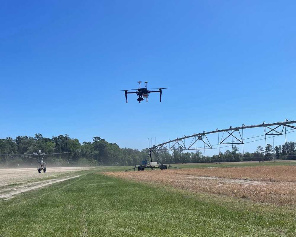
Hardware: DJI Matrice 100, DJI Zenmuse X5, MicaSense Altum
Software: Solvi’s Plant Health Maps, Zonal Statistics, Public Web Sharing
Flight Altitude: 35 meters (110 ft) Above Ground Level
Number of flights: 9 per season
Image resolution: 0.8 - 1.5 cm/pixel
Leveling the Playing Field
The beauty of this contest is the set of fixed variables. Corn plots are hosted side by side and managed by UF Extension, freeing growers to focus on key decision points:
- Seed variety selection
- Seeding rate
- Nitrogen management
- Irrigation management
- Crop insurance
- Grain marketing
Since farming is ultimately a business proposition, the contest rewards crop profit and water and nitrogen use efficiency, not simply yield. Growers had to carefully weigh their expenses and potential outcomes.
UF provided cutting-edge ag technology and training to democratize crop data amongst all teams. Data streams included:
- RGB, multispectral and thermal field imagery from drones
- Soil moisture sensing
- Soil and tissue sampling
- Irrigation apps
- Fertility application options
Growers Experiment with Ag Technology
Most participants were aware of drone technology, even if they hadn’t used it, so this was their chance to experiment with it without any cost,” Sharma said. “To familiarize them with all of the technology available, we hosted a kick-off training event on all the data platforms, including Solvi. We wanted teams to know exactly what information they had access to and how to use it.
Project partner Agribugs collected the drone crop imagery throughout the crop growing season. Solvi provided the imagery stitching, analytics, and data maps.
A lot of farmers don’t want to pay for a technology and not have a return on it,” said Darren Raj of Agribugs. “The program Vivek is doing helps them see the value of the technology in season. Hopefully, circulating these new technologies improves growers’ awareness and understanding and ultimately adoption in their own operations.
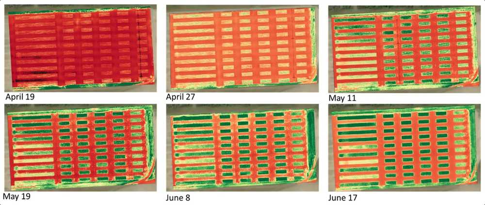
Plot imagery was updated biweekly from April to August for a total of 18 RGB and multispectral data sets provided to growers over the season. UF used a single Solvi account for the imagery uploads and admin and used a public share link to give growers functional access to all the contest data.
One visualization in Solvi’s platform rendered thermal imagery which clearly illustrated the impact of temperature and irrigation. Sharma said it became clear that teams were checking their plot data regularly.
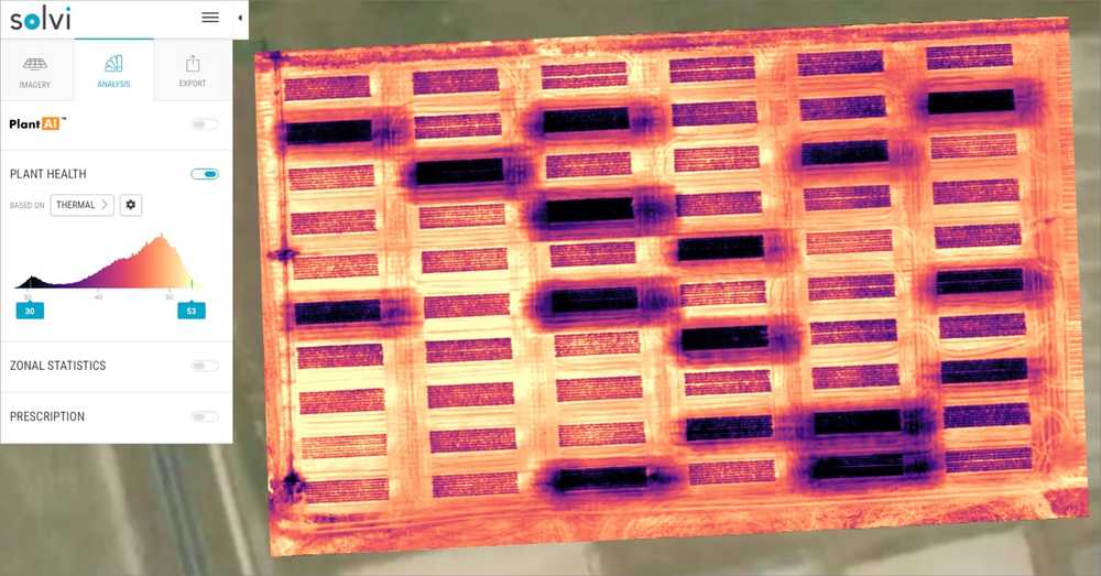
Since everyone had access to all of the contest data, participants could see both their own plots and others’ progress over time. You could tell which plots were being irrigated and which weren’t. It often spurred rapid management changes. I received many late-night emails and phone calls to add scheduled irrigation,” he laughed.
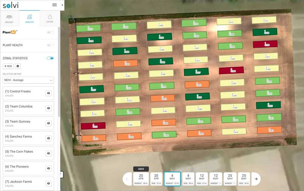
Other Solvi maps provided multispectral data that allowed growers to view and map multiple vegetation indices, including NDVI and NDRE, to evaluate plant health and crop nutrient response.
Web-Based Sharing
Having a cloud-based analytics platform was essential for the contest format. The large number of contest participants made desktop drone image processing nearly impossible. Sharing volumes of large file sizes with so many users would have been cumbersome and time-consuming.
Solvi’s web-based platform allowed UF and Agribugs to quickly and easily share the entire suite of fully interactive data to all contest participants to access on computers or mobile devices on the go.
It’s a big job to collect good data,” Raj said. “If the data isn’t good, the analytics are skewed. Solvi provides a great way to display and share complex crop data with a large group of users. It’s one thing to see a picture and draw inferences, but we want to rely on hard data and numerical correlations. Solvi made it easy for that to happen.
Correlating Tissue Sampling with Vegetation Indices
In addition to drone imagery, data points like soil moisture and tissue sampling rounded out the contest’s agronomic picture and provided ground truthing for the analytics data.
In a side project, UF is using Solvi’s analytics to explore different machine learning models to estimate leaf nitrogen content using the imagery vegetation indices.
In addition to the contest drone imagery, we were also collecting ground data like nutrient tissue sampling,” Sharma said. “This can be very time-consuming to collect and requires a 10-15 day wait for results. Growers usually need faster responses to make in-season decisions. So we are working to correlate nutrient concentrations with vegetation indices that can help us create predictive relationships. It’s something we didn’t have the capability to do before.
Winners Harvest Cash and Experience
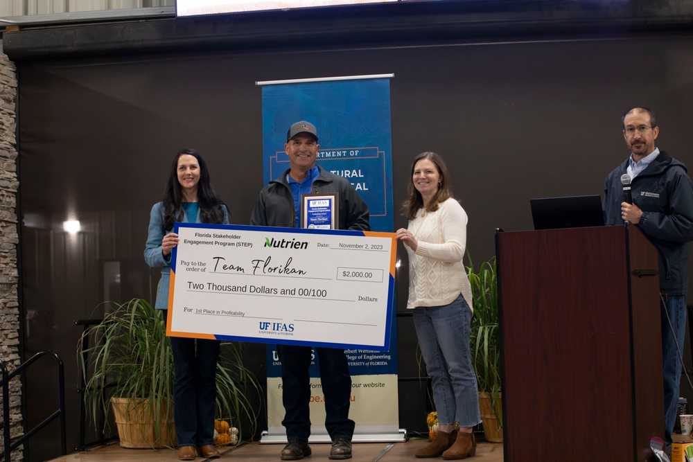
Team Florikan won the 2023 most profitable contest and Deas Farm won for highest input use efficiency. Only the growers on winning teams were eligible to take home the $2,000 first prizes. But the education was rewarding for all.
Contest outcomes change from year to year with real-world variables,” Sharma said. “This year, some of the teams lost money from their management strategies. The previous year, prices were higher so more teams showed profits, even if small.
So, were teams using the contest as an incubator to test different approaches or were they modeling what they were doing on their own farm operations?
Sharma says a bit of both.
At the outset, some teams gave us very specific directives on which inputs to use, which suggests they were replicating their farm plans. But some were clearly watching weather and sensor data to see where they could economize. It was very encouraging to see the growers using the data but we understand that the contest was happening concurrent with the busyness of their own growing season.
Gaming for Greater Impact
The contest serves as an excellent platform to showcase technology but also to highlight agriculture’s impact on water quality.
Regionally and globally, fertilizer management is a critical component of water quality, especially in areas where we have high precipitation or irrigation. North Florida has the highest density of natural springs in the world. They are a key water source for our state. We have to cut back to protect human and environmental health. The STEP contest lowers barriers to technology adoption that can help guide growers in nutrient decision-making.
Solvi Simplifies Precision Agriculture
The UF STEP contest aligns with Solvi’s mission to make agricultural data simple and actionable.
Solvi’s one-stop drone image stitching and analytics platform streamlines drone data workflow and simplifies plot analytics with tools designed by and for agricultural researchers.
- Complete all in one cloud-based platform. No 3rd party software needed.
- Flexible to work with any RGB or multispectral camera and drone combination.
- Simple four-step imagery upload process.
- Highly accurate plant counts and health analytics.
- Easy-to-use Zonal Statistics tool for quick extraction of plot boundaries.
- Easy online file sharing for full team access.
- Fast 30–60-minute image processing for immediate analysis.
The biggest contest learning component was not the installation or application of fertilizer or irrigation; it was about making decisions. Solvi made it easy to share complex data sets in a visible and actionable way, even for new users,” said Vivek Sharma, University of Florida.
